Seminar: Google Earth Engine for Systems Ecology and Conservation Design

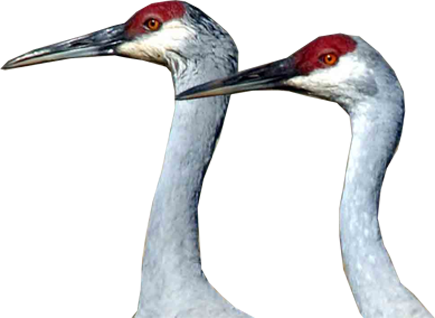
Photo courtesy of Brian Nesvik, Wyoming Game & Fish Department
Beginning in the fall of 2020, the Intermountain West Joint Venture (IWJV) and the University of Montana have offered a free virtual seminar each semester for agency and NGO science staff. The seminar, “Google Earth Engine for systems ecology and conservation design” is intended to bolster science capacity and collaboration across the IWJV partnership and beyond. Participants are trained in the use of emerging technology and cutting-edge techniques supporting a new era of ecological monitoring and wildlife management in the West. The class is targeted to scientists, technical staff, and conservation planners from state fish and wildlife agencies, federal agencies, NGOs, and universities. The range of participants—from seasoned conservation professionals to university graduate students who routinely collaborate with the IWJV—promotes diversity and innovative problem solving, and trains professionals to meet landscape-level conservation needs.
“By enabling partners we increase our collective capacity to leverage science to inform targeted conservation strategies and measure ecological outcomes,” said Patrick Donnelly, IWJV spatial ecologist and seminar instructor.
For more information on the course, see this class description.
Selection of Past Projects
Spring 2021 Projects
See recordings of Spring 2021 project presentations here.
Google Earth Engine Application for Arctic Grayling CCAAs—Willows, Water, and Habitat Trends
Jarrett Payne – Montana Fish, Wildlife, and Parks
Great Basin Riparian Resiliency Tracker
Cheryl Mandich – USFWS Partners for Fish and Wildlife
Fall 2020 Projects
See a recording of Fall 2020 project presentations here.
Can Google Earth Engine be a solution for organizing environmental covariates statewide?
 Liz Moore – Utah DNR, Wildlife Resources
Modeling efforts within Utah’s Division of Wildlife resources occur as large projects at the section level, as well as at the individual biologist level. One thing all efforts have in common is the need for accessible and up to date environmental data layers. Before covariates can be used in any division modeling effort, modelers now must independently identify and download environmental layers relevant to their projects. A coordinated environmental library would streamline this process and provide a framework for discovering data sources and improving modeling workflows. Google earth engine might just be one solution to a coordinated environmental data library accessible to all state of Utah modelers and partners.
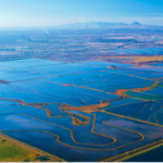
Using surface water dynamics to predict waterfowl distributions in California’s Central Valley
 Cory Overton – USGS, Western Ecological Research Center
Producing spatially explicit maps of the Central Valley of California at time frames sufficient to capture both the dynamism of habitat availability and use by waterfowl is a challenge. This limits both the analysis of ecological drivers of population dynamics and the habitat management options available to address resources deficiencies across large landscapes. This project used the Google Earth Engine (GEE) platform as a venue to combine three different satellite image collections to develop an object-based binary habitat condition (flooded or not flooded) model among all available data. The resulting map classified nearly 45,000 fields more frequently than weekly (on average) as flooded or not flooded.
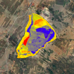
Monitoring long-term changes to CRP in SE Wyoming
Grant Frost – Wyoming Game and Fish Department
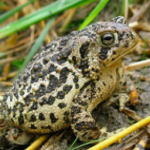
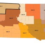
Modeling Wyoming Toad Habitat in the Laramie Plains
 Noelle Smith and Erica Cirigliano – Wyoming Game and Fish Department
The Wyoming Toad is an endangered species found in Albany County, Wyoming. This project begins the development of a tool to model suitable Wyoming Toad habitat within the area by focusing on wetland hydroperiod and mesic habitat. This tool could help identify locations for toad reintroduction and provide more information on hydrology at locations currently supporting the species.
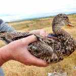
Wetland bottlenecks to waterfowl molt migration between the Central Valley and Southern Oregon
 Desmond Mackell – USGS/University California Davis
Molting is a vulnerable life history stage for waterfowl. During this time, birds are unable to fly and dependence on reliable wetland habitat is critical to survival. Strong molt site fidelity may indicate a selection for historically stable wetland resources. This project looks at long-term water trends in the wetland sites used by waterfowl during molting life cycles to determine the stability of these landscapes.
Monitoring riparian response to BDA restoration in SW Idaho
Sonya Knetter – Idaho Fish and Game Department
Cross boundary solutions for wetland and waterbird management for Arizona, New Mexico, and Mexico
 Antonio Cantu – Louisiana State University
Wetlands in the Chihuahuan Desert serve as crucial stopover and wintering grounds for migratory birds, particularly for waterfowl, shorebirds, and Sandhill Cranes. These wetland habitats are naturally dynamic, subject to dry and wet periods over the years which drive their productivity. However, human activities (e.g. water diversion and agriculture) and climate change have affected surface water dynamics throughout these sites, directly affecting habitat availability for migratory birds. This project analyses long-term inundation dynamics and trends in these key wetland habitats.
Evaluating Resource Availability and Use of pronghorn, mule deer and whitetail deer in South Dakota
 Molly McDevitt and Anna Moeller – University of Montana
This project evaluates population dynamics, movement, and resource selection of mule deer, whitetail deer and pronghorn. Assessment of resource selection is typically conducted through modelling tools called Resource Selection Functions (RSF). RSFs require GPS location data from wildlife populations of interest (used points) in addition to a large number of available locations that wildlife had access to but did not select (available points). This evaluation allows researchers to assess which resources may be of greater valuable than others for wildlife.
Using Google Earth Engine to Develop an Insect Harassment Index for Arctic Ungulates
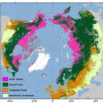 Libby Ehlers – University of Montana
Climate change across the arctic and boreal regions is happening three times faster than anywhere else on the planet. Warming temperatures create a ‘greening’ arctic resulting from longer growing seasons, increased precipitation, and faster decomposition rates while the increased severity and frequencies of wildfires are creating a ‘browning’ boreal forest. Species requiring late-successional habitats are responding negatively to these changes in the structure and function of vegetation communities. This research looks at how the summer diet of a migratory caribou (Rangifer tarandus grantii) population is responding to these changes.